Wonder Wednesday 130: Nature’s Weather App
Moving off and up from the Earth's crust into the hydrosphere and atmosphere, stay in tune with summer storms - from hurricanes to afternoon thunder showers - by honing your nature observation skills!
You can do this with a fun and historic little thing called the Beaufort Scale! Sure there are apps and online reports, but humans have been usefully tracking weather - for all sorts of reasons from personal safety to food sourcing - by observing nature since the beginning of time.
Have you ever noticed how surfers are super in tune with the ocean and the weather conditions - even before all the silly (and often incorrect btw) surf report apps? Well it comes from endless hours observing and spending time in the sea! But this skill doesn't need to be exclusive to surfers, sailors, and sea-loving people!
This Wonder Wednesday 130, let's practice using our brains and bodies to tune into the weather around us! Because our smart minds never run out of batteries or lose wifi like our "smart" phones!
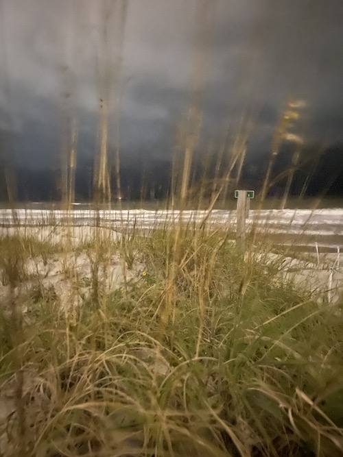
(Of course always use modern technology to stay safe during storms and always follow local safety recommendations.
This scale is for fun in nature journaling and non-threatening situations.)
The Beaufort Scale
The Beaufort Scale was created in the 1800s as a way for sailors to consistently and clearly describe wind strength to each other.
While describing and applying wind conditions has been done by humans around the globe for as long as humans have been around the globe, the terminology on the Beaufort Scale was finalized in 1805 by Irish Hydrographer Admiral Francis Beaufort.
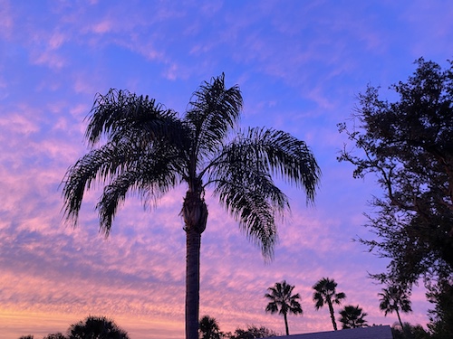
The "0 Calm"This was taken the evening before a category 1 hurricane arrived.
The scale was first officially used on the voyage of the HMS Beagle.(Sound familiar? That's the famous voyage of Charles Darwin.) The scale estimates wind speed based on observations of the wind's effects on either land or sea conditions.
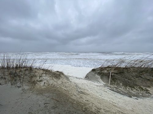
For example, the photo above is a 12 on the Beaufort Scale because you can see that the foam is covering everything and spraying over the dunes. (I took this during a category 1 hurricane last fall.)
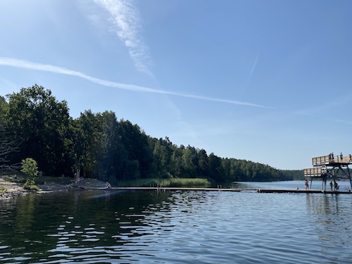
I'd rate this day's weather, in the photo above, a "1 Light Air" condition because of the small ripples, but still glassy surface.
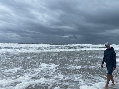
This day was a "9-10 Strong Gale/Storm" because it was definitely hard to walk and those waves were waaaay bigger than they look in this photo.
Play around with aligning your nature observations with the scale to guide you in naming and describing the types of wind you observe. Try documenting your ratings and observations and see if you can track any patterns.
Soon you'll be the one predicting the weather for a picnic, seeking the perfect glassy waves to surf at the beach, or knowing when to head for the house or the hills if a force 10-12 wind is headed your way!
Since summer's afternoon thunderstorm season is here, try honing your observational meteorology skills using the Beaufort Scale funsheet pdf!
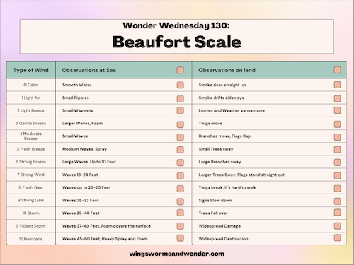
Materials:
All you need for this Wonder Wednesday project is the Beaufort Scale pdf (click here to download) and a window or access to the outdoors
Optional: Nature journal, and anything else you like from a compass to binoculars to barometers!
Preparation/Procedure:
Look out the window, or go outside and use any combination of sight, hearing, and feel senses to observe the wind, sky, and weather to make predictions about the day's forecast.
Have some fun with the weather this summer while you sharpen up your meteorology communication skills!
Extension
Create a summer atmosphere journal and document the wind using your Beaufort observations and the sky using the Wonder Wednesday 81 Summer Cyanometer project!
Let's practice. What's your surf report for the photo below?

I'd say we have clean waves, a smoothish surface, but a bit of off shore wind out of the west from the look of that spray, so maybe a "5 Fresh Breeze"?
(This photo was taken in the town of Bathsheba, on the island of Barbados, so I know that we are looking east out into the Atlantic, so the back spray on the wave is being driven by a west wind.)
